for the map:
http://www.lib.utexas.edu/maps/ams/western_europe/
http://loadmap.net/en
These maps will be the base for the Bastogne map. As we see the elevation are available, there WWII maps to check the changes, and these are the maps to use.
All of them should be georeferenced and loaded to manifold and the mapmaking can be started.
Showing posts with label map. Show all posts
Showing posts with label map. Show all posts
Monday, September 10, 2012
Monday, September 3, 2012
map
Two maps of Bastogne from wikipedia (out of copyright, public domain):
http://upload.wikimedia.org/wikipedia/commons/c/ce/Bastogne%2C_Belgium_Map.png
http://upload.wikimedia.org/wikipedia/commons/c/cc/Fifth_Panzer_Armee_Attacks_28th_Infantry_Division.png
and one more (out of copyright, public domain by law):
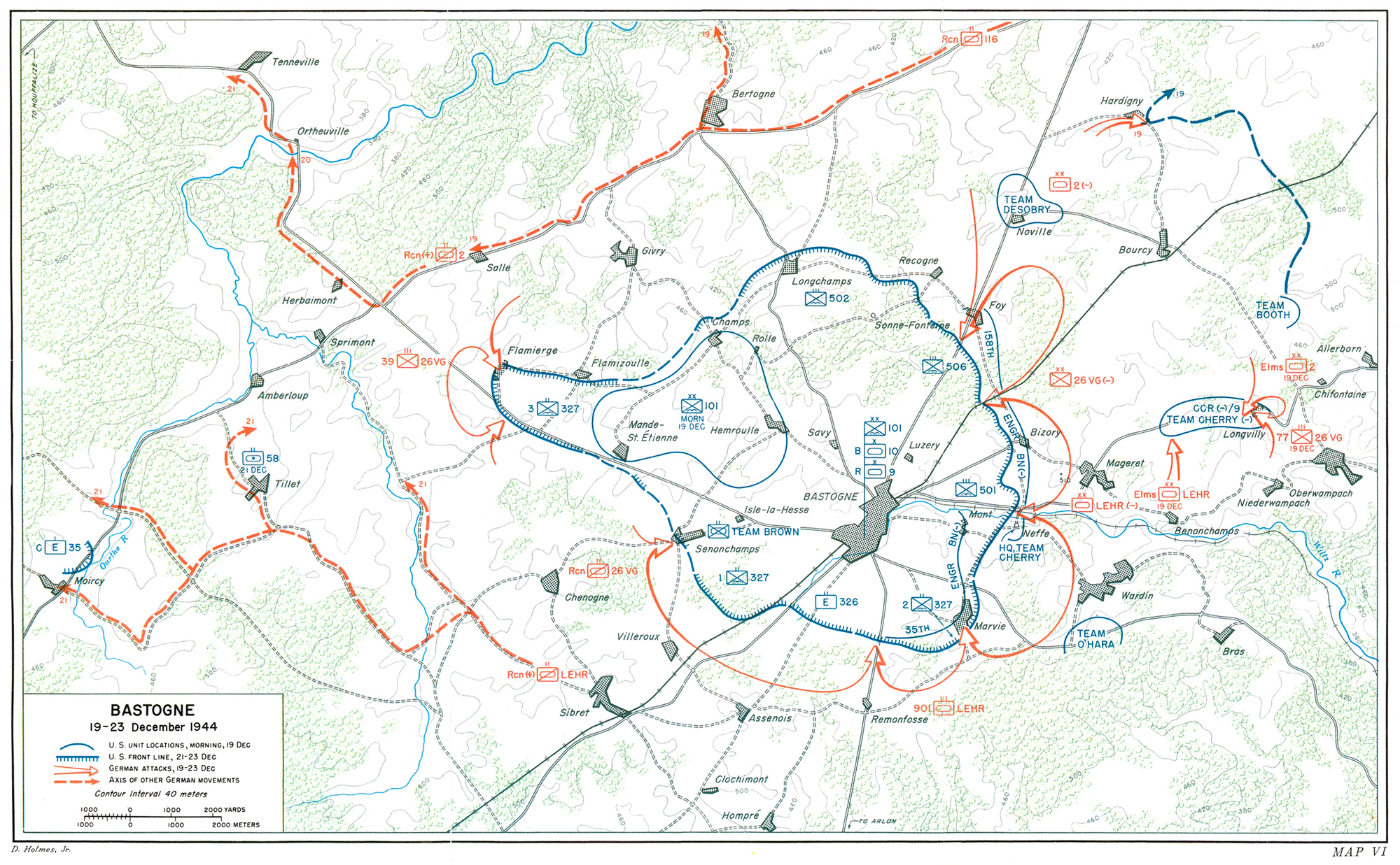
http://www.ibiblio.org/hyperwar/USA/USA-E-Ardennes/maps/USA-E-Ardennes-VI.jpg


http://upload.wikimedia.org/wikipedia/commons/c/ce/Bastogne%2C_Belgium_Map.png
http://upload.wikimedia.org/wikipedia/commons/c/cc/Fifth_Panzer_Armee_Attacks_28th_Infantry_Division.png
and one more (out of copyright, public domain by law):
http://www.ibiblio.org/hyperwar/USA/USA-E-Ardennes/maps/USA-E-Ardennes-VI.jpg


Subscribe to:
Posts (Atom)